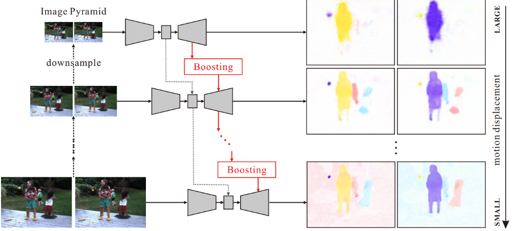
Jun Pan, Guo Ye, Ying Zhu, Xiaolin Song, Fen Hu, Chi Zhang and Mi Wang. Jitter Detection and Image Restoration Based on Continue Dynamic Shooting Model for High-Resolution TDI CCD Satellite Images. IEEE Transactions on Geoscience and Remote Sensing, 2021, 59(6) (SCI)